That's referring to the much larger river to the west.
Technically that whole region rests on a sort of plateau. Though vague and probably not very telling the dashed marks to the south of your present location indicate cliffs, or at least some sharp or noticeable drop-off of altitude (in geographic terms). The river that makes your southern border travels west into the lake before going south, over the cliffs or through that landscape there, and out into the sea through region 3.
The river/river-system I discuss in that part of the post is the central one that branches out. It's flowing out of the mountains and into the drier steppe beyond there.
Region 1 is one of the more diverse areas of the map, lumped together mostly because it's one continuous piece of flat-lands. Where you're at I would describe as being sort of like certain regions of Kazakhstan.

Or the Manchu-Mongolian grasslands.

This being that the gap in the mountains provides an opening in the rain curtain that otherwise exists and for warm hair to channel north, keeping that area moist and comfortably warm. The prevailing southerly winds would also connect with the northern winds and basically keep them out. There'd be seasonal fluctuations, but all around that region is warm.
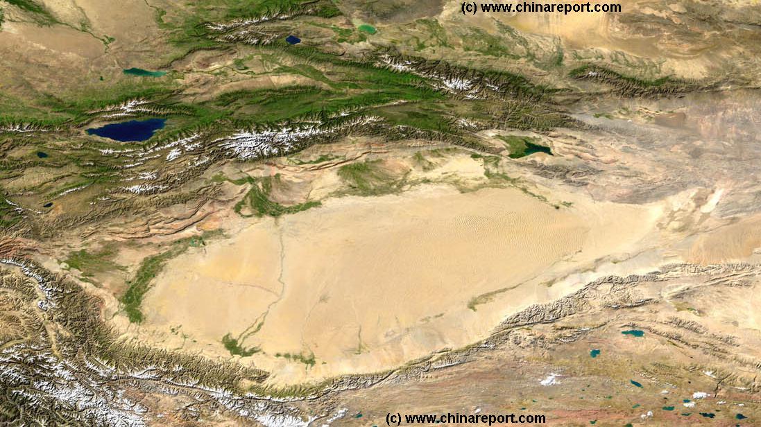
By comparison, because there's a mountain range that stands in the way of the rest of region 1 from the lush south, this creates a rain curtain which makes the rest of the territory resemble something like the Taklamakan Basin.

As seen here from space.
Under different circumstances - namely: the Himalayan mountains and the Tibetain Plateau never existed - the Taklamakan Basin would be a pretty warm and green region. But because the Himalayas are there it prevents any and all moisture from reaching the desert and the climate is predominately run by cold, dry, Siberian air from the north.

Don't let the sand fool you. At the worse times the desert can get to be nearly -20 degrees celsius and it rarely ever snows.
A similar rule would be in play for the desert there. But every so often a rogue cell may drift along the northern face of the mountains. But any and all water out there does not come from assured rainfall. But run-off from glacial melt in the mountains or springs.
So in closing: western 2/3rds of region one are cold and arid because rain curtain and arctic air dominating the environment. Eastern 3rd is warmer and wetter because there's a break in the rain curtain letting in warm moist air and not trapping it on the southern face of the mountains. And as a whole the region is elevated higher than the south, and even that not-mountain pocket of region 3, which would factor in but not so much in the eastern part of the region as the central/western.
EDIT - I would also like to revise my earlier statement that the area Maav is in would be the equivelant to Egypt when gauged by latitudes. It'd probably be more comparable to northern-Italy or Austria, if not for the Alps. Or the grasslands of Eastern Kazakhstan.


